The use of satellite data to monitor cultivated areas of the country’s economic crops
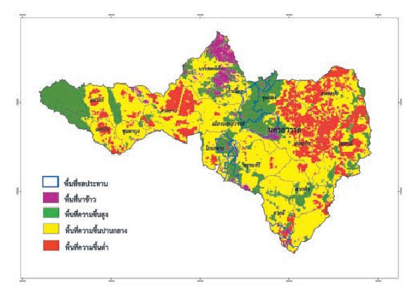
GISTDA uses the geo-informatics and space technology to support the Government’s operating procedures in agricultural land management, particularly what concerning the country’s main economic crops—rice, corn, tapioca, and sugarcane—by monitoring cultivation of the four crops once every two weeks, from the Terra & Aqua MODIS Satellite data. Besides, the cultivation period of each area is also analyzed, allowing for prediction of the harvest day and estimated yields at different periods in each area.

For quick monitoring of the cultivation situation, GISTDA has developed a monitoring system to watch over the cultivation of national economic crops at http://rice.gistda.or.th/ecoplant.isp. The system provides online maps of crop cultivation areas which the concerned agencies can access, make use of the current information for efficiency of their management.