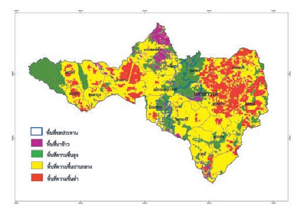
Satellite data and geo-informatics data for management of the integrated rural livelihood development model for Kaen Makrut Sub-district, Ban Rai District, Uthai Thani province based on Royal Initiative
GISTDA and the Royal Initiative Discovery Institute have jointly implemented the Integrated rural livelihood development model at Moo 1 Ban Tai, Moo 2 Ban Khlong Salao, Moo 3 Ban Mai Khlong Ung-wa, and Moo 4 Ban Emart-Esai, Kaen Makrut Sub-district, Ban Rai District, Uthai Thani province, covering the area of 14,454 Rais 97 Sq.Wah. The project uses data from the high-resolution Satellite “Thaichote” and the involved geo-informatics data for area-based management, such as creating a plot-based land use database, managing and solving problems of water for consumption and agriculture, and monitoring forest area changes. The project has yielded good results as people in the four villages subsequently have quality and better living, and become self-dependent by taking H.M. the King’s royal initiative to improve their locality and communities, making the project an integrated rural development model to be applied for sustainable management in other areas.

Image from the Thaichote Satellite on January 14, 2013 covering area of the integrated rural livelihood development model for Kaen Makrut Sub-district, Ban Rai District, Uthai Thani province based on Royal Initiative, and activity photos showing how the satellite and geo-informatics data was used for area-based management.