![[node:title]](http://203.150.224.57:81/ewtadmin86_gistda/ewt/gistda_web/images/articleimg_2021081314114946725.png "[node:title]")
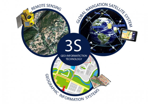
Geo-information technology refers to an integration of knowledge and technologies involving Remote Sensing (RS), Geographic Information System (GIS) and Global Navigation Satellite System (GNSS) to be applied in a wide range of work. Remote sensing is an important technology for studying elements on the global surfaces and atmosphere. The objective is to study and monitor changes of natural environment by choosing data from a wide variety of high-resolution satellites, and applying them for individual purposes. Furthermore, Remote Sensing data can be retrieved quickly, and able to respond immediately to certain demands, while the GIS can manage spatial data, analyze and apply the data for efficient management of natural resources. In addition, the GNSS can be used for quick and precise area-based positioning and monitoring of human and object movements. The Geo-information technology is therefore an important science used by many agencies for a wide range of development, such as natural resources and environment, agriculture, city planning, traffic and transportation, military stability, natural disasters, and business trade. Results of analysis with GIS technology can be applied to any decision making plan quickly and accurately.