The National Aeronautics and Space Administration, or NASA, is well known for its solar system exploration missions and the space telescope that peers back toward the beginning of the Universe.
However, Earth is where NASA has most of its satellites and instruments in orbit, along with multiple research and studies of our planet's oceans, land, ice, and atmosphere from space.
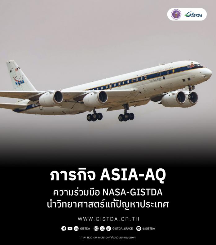
With the ever-changing pollution globally, NASA and its partners wanted to understand the factors that affect air quality in Asia. NASA's DC-8 "Airborne Science Laboratory" and NASA Langley Gulfstream III aircraft will fly over multiple regions in Thailand between March 16-25, as part of the Airborne and Satellite Investigation of Asian Air Quality or ASIA-AQ mission.
This mission is the partnership between NASA and South Korea’s National Institute of Environmental Research or NIER. Both parties collaborated on the development of the Geostationary Environment Monitoring Spectrometer or GEMS, which was launched aboard the GEO-COMPSAT-2B satellite towards geostationary orbit in February 2020.
While the GEMS instrument measures air quality above Asia, NASA also contributed to the Tropospheric Emissions: Monitoring of Pollution or TEMPO instrument aboard the Intelsat 40e satellite, to continuously measure air quality above the North American continent. The European Space Agency or ESA will launch the Sentinel-4 satellite to measure the air quality above the European region in the upcoming future.
Since data from satellites cannot be used to understand all the factors contributing to pollution and air quality problems, the ASIA-AQ mission will conduct an airborne sampling across multiple locations. The data gathered from both DC-8 and GIII aircraft will be used in collaboration with data from satellites and ground sites across Thailand.
The DC-8 airplane will make a low approach at multiple airport runways in Thailand, along with flying at multiple altitudes to map out the column density of aerosols and factors that contribute to air pollution in Thailand. At the same time, the GIII aircraft will maintain an altitude of approximately 28,000 ft as a mission of remote-sensing the air quality and overall greenhouse gas emissions.
All the data gathered from both aircraft, in collaboration with data from satellite and ground sites in Thailand, will be used by researchers from multiple organizations. The partnership between NASA, NIER, and the Geo-Informatics and Space Technology Development Agency or GISTDA will use science and geo-information to tackle the problem of air pollution in Thailand, according to one of the policies of the Ministry of Higher Education, Science, Research and Innovation of Thailand.
NASA and GISTDA, in collaboration with NARIT, the Pollution Control Department, Silapakorn University, and King Mongkut's Institute of Technology Ladkrabang, will analyze the data obtained from multi-perspective observations and modeling. All the results and findings from the ASIA-AQ mission will be made public within one year, as a foundation for future policy-making related to the pollution problem in Thailand.
Once again, the technology that makes us look further beyond into the far unknown of deep space also contributes to a better understanding of planet Earth, our only home known to all humankind in the entire Universe.